
One year after the 2015 Butte Fire destroyed nearly 500 residences nearby, CAL FIRE identified the South Fork Mokelumne River watershed as a top priority for fuels reduction in order to protect communities from future wildfires. With the recent completion of the South Fork Mokelumne River Watershed Restoration Project Phase 3, many of those wildfire worries have, fortunately, been doused.
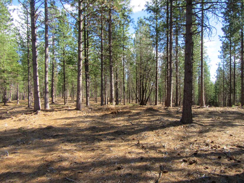
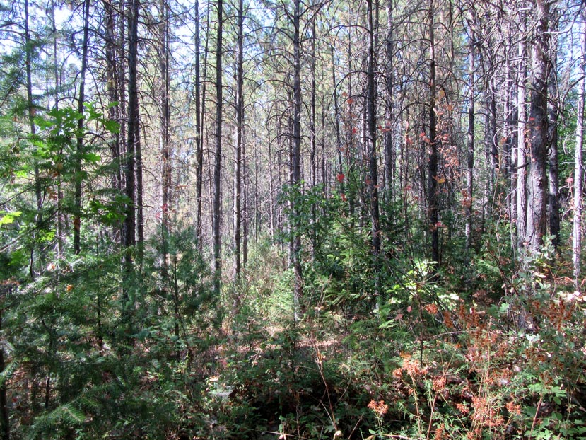
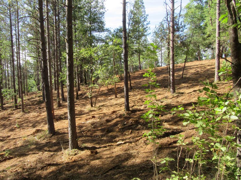
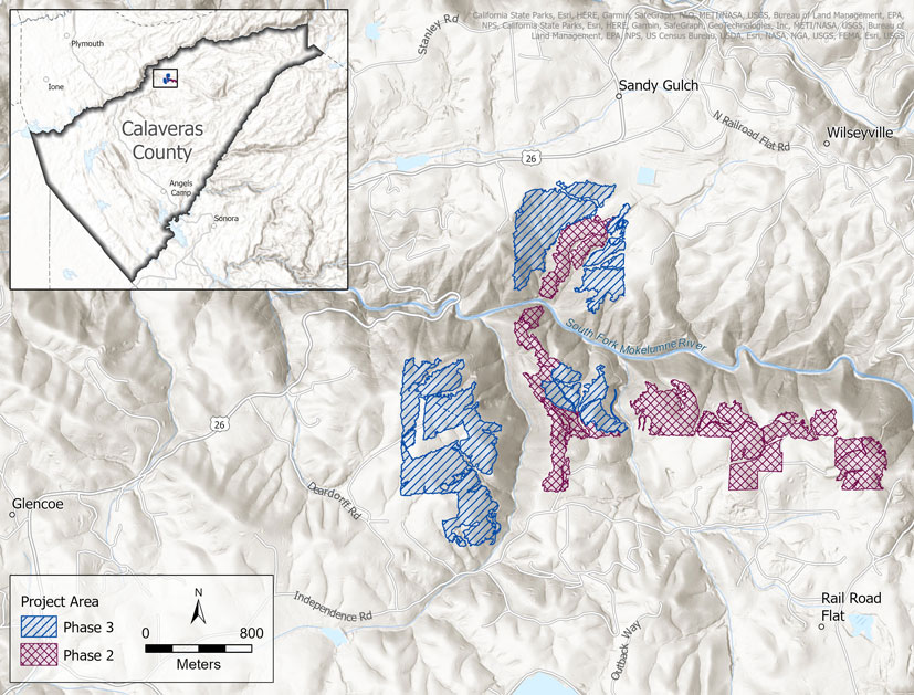
Funded by the Sierra Nevada Conservancy (SNC) in 2019, Phase 3 removed small-diameter trees and ladder fuels on 285 acres of dense, pine-plantation forests managed by the Bureau of Land Management (BLM), completing the project’s goal of restoring roughly 500 acres of forest. Considering the project area borders many neighborhoods and is surrounded by nearby towns, such as Glencoe, Sandy Gulch, Rail Road Flat, and Wilseyville, this strategic work should greatly reduce the threat of wildfire for thousands of Calaveras County residents.
A critical cross-river fuel break
The recent Phase 3 work is an ideal complement to Phase 2 of the South Fork Mokelumne River Watershed Restoration Project that removed hazardous fuels from 217 acres of adjacent BLM forests. The second phase of the project was completed in September 2020, and included a strategic 1.8-mile fuel break that runs along both rims of the watershed to help with potential future firefighting efforts.
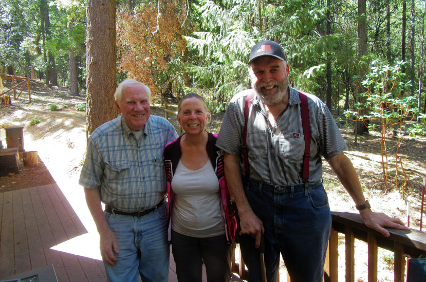
“There’s a ridge that actually crosses over the South Fork Mokelumne River,” said Pat McGreevy, a member of the Calaveras-Amador (Cal-Am) Forestry Team that oversaw all phases of the project. “CAL FIRE’s goal was to put in a fuel break across the river. They wanted that fuel break to act as an anchor to put their suppression forces and be able to drop retardant from the air. The goal was to stop, right there, any fire going upstream or downstream.”
Local volunteers helping to protect communities from wildfire
The grants that funded both projects were awarded to Calaveras Healthy Impact Product Solutions (CHIPS), a nonprofit organization focused on creating healthy forests and wood-based economies in the area, but it was McGreevy’s Cal-Am Forestry Team that handled most of the planning, design, and project management. The team, which formed after the devastating Butte Fire, is comprised of local volunteers looking to help protect their forests and communities from wildfire.
“We designed the project, and we did the contracting and invoicing – the whole nine yards,” said McGreevy, a GIS expert. “We are retired folk, and we try to do all aspects of a project from design to completion to monitoring to maintenance. That is our model.”
That model, according to McGreevy, would not be possible without the help of vital partners, like the SNC and the BLM.
“We are totally thankful to the SNC. The SNC got us started,” McGreevy said. “That partnership, and the partnership with the BLM, are most fruitful. Absolutely fundamental to getting work done!”
Strategically linking projects into a ‘wildfire defense system’
Along with other fuels-reduction projects going on, including SNC-funded work near Lilly Gap and Bummerville, and along parts of the Highway 26 and Highway 4 corridors, McGreevy is hopeful these vital treatments will strategically link together into what he calls a “wildfire defense system.”
“Our ultimate goal is to wire all these fuel breaks together into one system to protect the whole northeast of Calaveras County,” he added. “We are into building systems, not a shotgun approach, but systems.”
Thanks to the work of the Cal-Am Forestry Team, CHIPs, BLM, and all other partners involved, the restoration of the South Fork Mokelumne River watershed has become a key component of that critical wildfire defense system.