

The Tuolumne River Trust has used RFFCP resources to pilot the innovative use of drones as a cost-effective way to view forest structure. Their promising results are being shared with other forest restoration groups. Watch their introduction on the use of Unmanned Aerial Vehicle (UAV), aka drones, for forest restoration project planning and monitoring.
Tuolumne River Trust innovates with drone data
By Byron Krempl, Tuolumne River Trust
A common adage is that, “if you can’t measure it, you can’t manage it”. While this isn’t entirely true, when conducting landscape restoration it is key to know what our landscapes look like, showing where and why we need restoration activities.
We have gotten better at using technology to assess landscapes. We still conduct our boots-on-the-ground inventories, but we can also use satellite data, aerial imagery, and more to get a bigger and better look and understanding of our landscapes, how they’re functioning, and how we can work with nature to enhance restoration and ecosystem function. The Tuolumne River Trust is on the cutting edge of these new technologies, and is now piloting a project funded by the Sierra Nevada Conservancy to use UAV systems (drones!) for landscape modeling and assessment.
Our process
Step 1
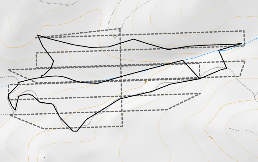
We identify the project area. We can’t fly a drone over a million acres, but we can use it to take a hard look at unique landscapes and project areas.
Step 2
We create a flight plan. We can control variables like the resolution we need, as well as identify no-fly zones and other factors to make sure we follow all FAA rules and regulations.
Step 3
We go out and fly! We can fly roughly 40 acres on a single battery, or roughly 80 acres an hour. Can you imagine how long it would take to go walk around and look at each square foot of an 80-acre project area?
Step 4
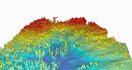
We use algorithms and programs to create a 3D model of the landscape, allowing us to go back and look at the landscape at any point in time, effectively allowing us to virtually go out in the field, or virtually go back in time!
Step 5
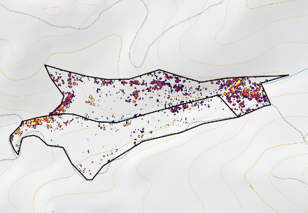
We use even more algorithms and programs to create maps of the ground, vegetation, and trees. This allows us to visualize data like percent canopy cover and canopy height, which are important variables for many critical species in the Sierra Nevada!
Step 6
Once we have all of this information, we use it to plan and monitor treatments, prioritize project areas, and more!
The sky is the limit
This is a reforestation project that we will continue to monitor, showing new tree growth over time in the footprint of the 2013 Rim Fire. By the end of the year, we will have tested this technology on fuels reduction projects, showing the before-and-after conditions of a strategic treatment designed to minimize wildfire risk within the Tuolumne River Watershed.
Thanks to the support of the Sierra Nevada Conservancy, we are improving restoration practices for the benefit of forests, wildlife, and communities.
Background
The Tuolumne River Trust is a Sierra Nevada Conservancy Regional Forest and Fire Capacity Program (RFFCP) grantee. Through the Sierra Nevada Watershed Improvement Program (WIP), SNC allocates RFFCP funding to organizations and agencies in the SNC Region, encouraging them to build new partnerships, test new strategies, and fill capacity gaps. Sharing these strategies will help all Regional stakeholders to be more effective in their forest restoration and fire resilience work.