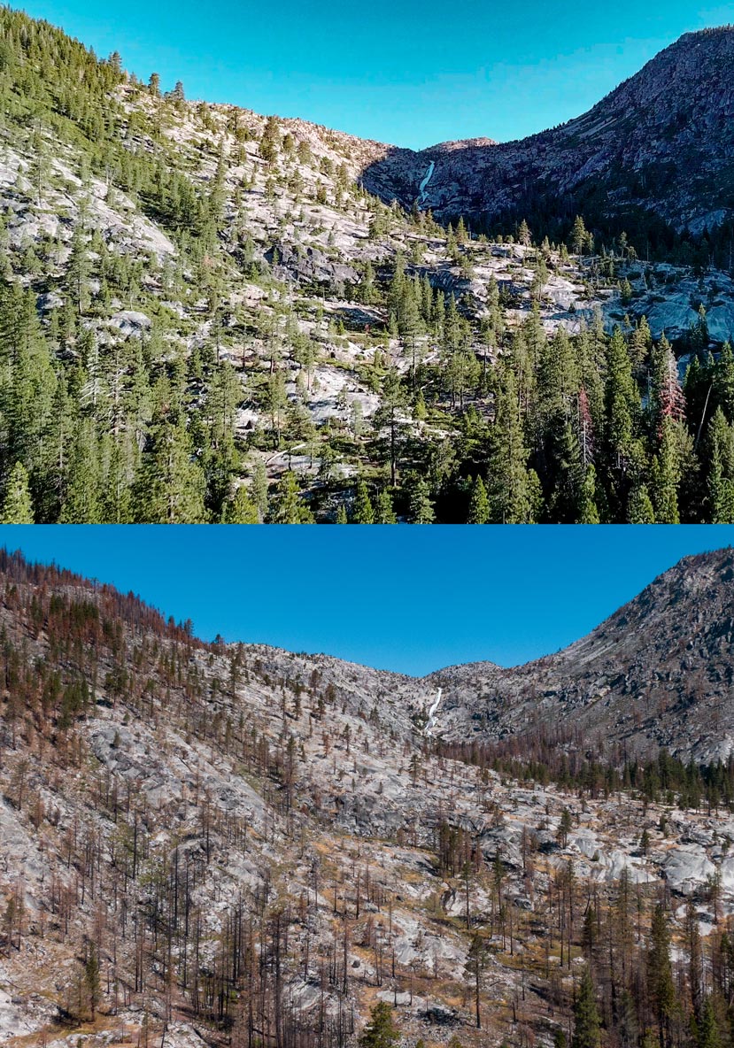
One year ago, the world watched as the Caldor Fire ignited in the Sierra Nevada foothills and burned up and over the rocky crest of the mountains to the southern shores of Lake Tahoe—impacting communities and landscapes along its path.
A year later, some lessons are clear. What we do before wildfires ignite can make all the difference on the ground. Landscape-level fuel reduction done before the Caldor Fire played a critical role in protecting natural areas like the Caples Creek watershed while defensible space in the wildland urban interface was pivotal for mountain communities like Sly Park, Pollock Pines & South Lake Tahoe.
Equally clear is the toll taken by the Caldor Fire, just one of several California megafires that burned during the historic 2021 fire season. Treasured Sierra Nevada landscapes, hundreds of homes, including the town of Grizzly Flats, and important economic drivers like the Sierra at Tahoe Resort suffered heavy damage.
More thorough assessments of the fire’s many other impacts, whether to the state’s carbon stores, water quality in our rivers, or regional biodiversity, will take time. Even so, a year after the Caldor Fire it serves as a stark reminder of both what’s at stake in California’s climate and wildfire crisis, and some of the steps we can take to protect the many shared riches of the Sierra Nevada.
Drone imagery of the burn area before and one year after the Caldor Fire
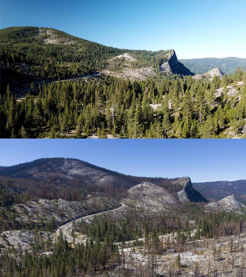
The SNC’s work takes us, and our drone, to a lot of special mountain places. We recently returned to an iconic stretch of California’s Highway 50 to see how the post-burn landscape compared to images taken a few years prior.