Service Area

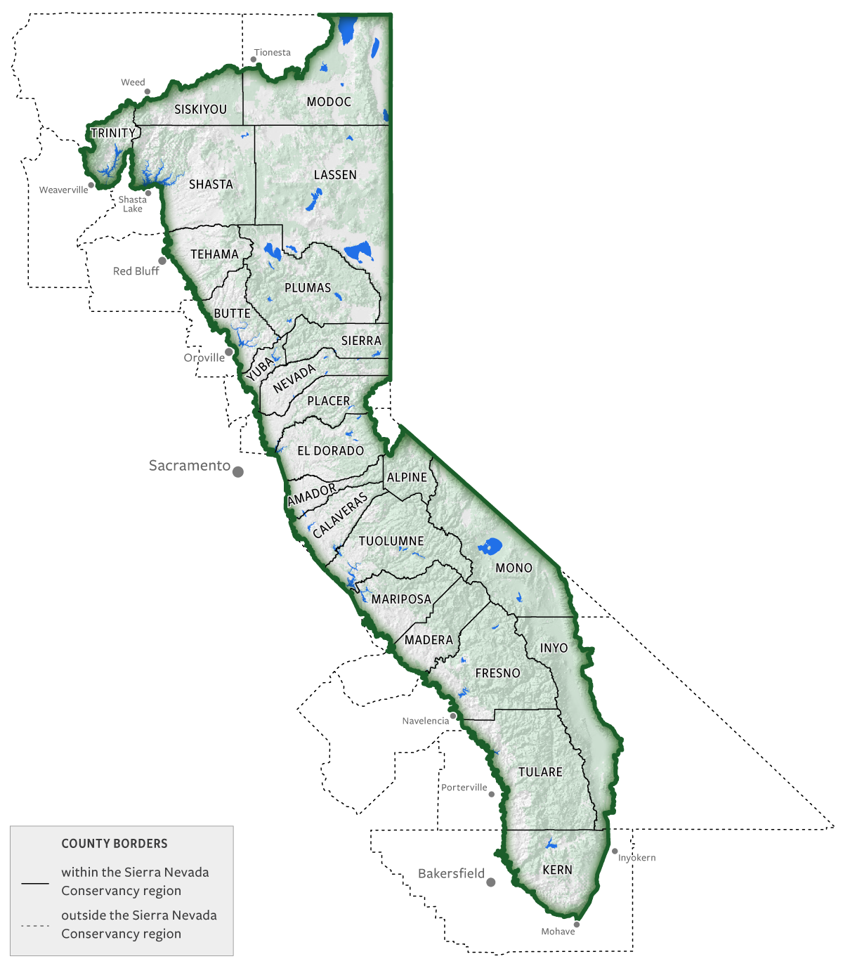
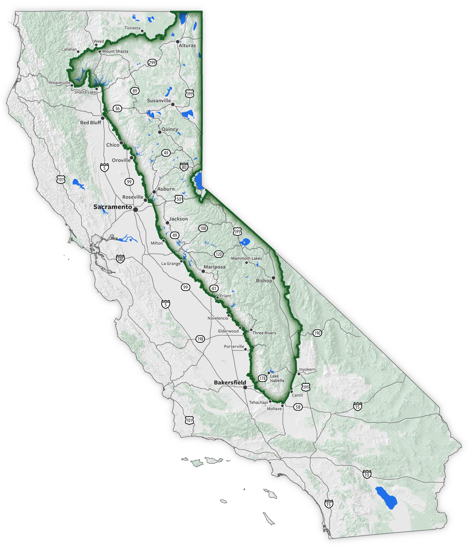
We serve California’s Sierra-Cascade region, which covers almost 27 million acres and 25 percent of California’s total land area. It is one of the largest conservancy service areas in the state.

The region is critical to California’s water system and contains all source watersheds for both the State Water Project and the Central Valley Project.

Overview

Our service area includes the mountains and foothills of the Sierra Nevada range, the Mono Basin, Owens Valley, the Modoc Plateau, and parts of the southern Cascade Range and Klamath Mountains.

SNC boundary is on the eastern side of California against the border with Nevada. Moving counterclockwise from north to south, the boundary is bordered by: Tionesta, Weed, Callahan, Weaverville, Shasta Lake, Red Bluff, Chico, Oroville, Roseviile, Milton, La Grange, Navelencia, Elderwood, Porterville, Tehachapi, Mohave, Cantil, and Inyokern. Highways 99 and 5 are west of the boundary, except for when 5 passes between Shasta Lake and Mount shata—the boundary extends to the west. Highway 58 travels along the southern portion of the boundary. Inside the region from north to south: Alturas, Mount Shasta, Susanville, Quincy, Auburn, Jackson, Mammoth Lakes, Mariposa, Bishop, Friant, Three Rivers, and Lake Isabella. Highway 89 is in the region south of Weed. Highway 395 is in the region from the border with Oregon until just before crossing highway 178. Highway 49 is entirely in the region.

Counties

Our service area includes all or part of 24 counties in California.

Map of counties within the region. From north to south: most of Modoc (except north west corner), south eastern corner of Siskiyou, north east corner of Trinity, most of Shasta (except south western corner), all of Lassen, eastern third of Tehama, all of Plumas, eastern half of Butte, all of Sierra, eastern two-thirds of Yuba, all of Nevada, most of Placer (except western edge), all of El Dorado, all of Alpine, all of Amador (except tiny portion along western edge), most of Mono, except south eastern edge), all of Calaveras (except tiny portion along western edge), all of Tuolumne, most of Mariposa (except south western corner), over half of Madera (eastern side), eastern half of Fresno, western edge of Inyo, most of Tulare (except western side), north eastern piece of Kern (bordered by Bakersfield, Mohave, and Inyokern).